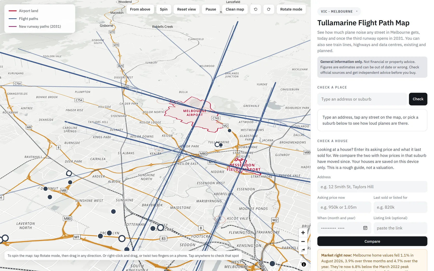
Type any address and see how loud planes are there in plain words, today and once new runways open. You also get the suburb's house prices, crime, schools, and what's being built nearby.
2,668 suburbs4,196 rated schoolsWorks on your phone
flightpathaustralia · Melbourne
Check a house · St Albans
Down $420,000
From $1.2m (03/2019) to $780k now, while St Albans house prices moved up 10.7% over the last 12 months.
8 capital cities2,668 suburbs mappedHouse prices for 2,140 suburbsPolice crime figures for 2,577 suburbs4,196 rated schoolsFlight paths, today and after new runwaysData centres, rail and motorways, existing and planned
Plain words, not decibels
Five levels you can actually picture.
Every street gets one of five levels, each described as something you have already heard. "Loud" starts where a plane stops a conversation indoors with the windows open, the same level airports use when they count noisy flights. Tap a level.
See it work
Two checks every buyer should run.
These are real answers from the map, played back. Type your own once you're in.
1Check a place
How loud is it, really?
Type an address or suburb
Check
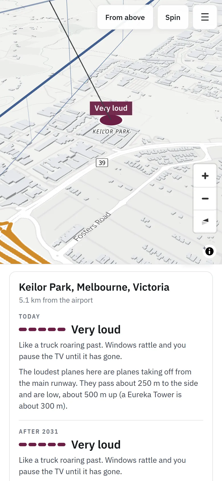
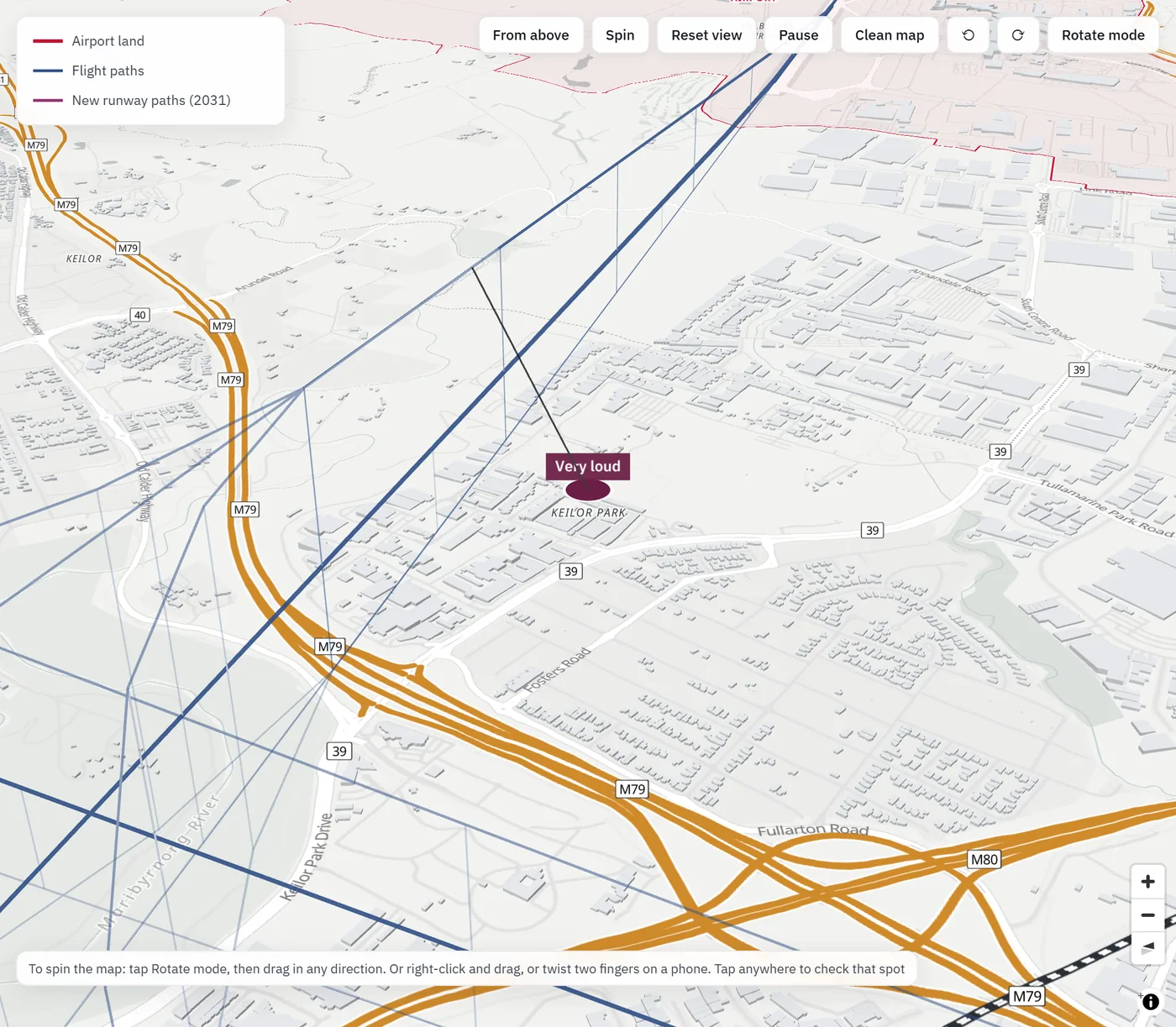
Keilor Park, Melbourne, Victoria
5.1 km from the airport
Today
Very loud
Like a truck roaring past. Windows rattle and you pause the TV until it has gone.
The loudest planes here are taking off from the main runway. They pass about 250 m to the side and are low, about 500 m up (Eureka Tower is about 300 m).
The same card shows "After 2031", once Melbourne's third runway opens, plus crime, prices and schools for the suburb.
2Check a house
Is the asking price fair?
e.g. 950k
e.g. 820k
Month and year
Compare
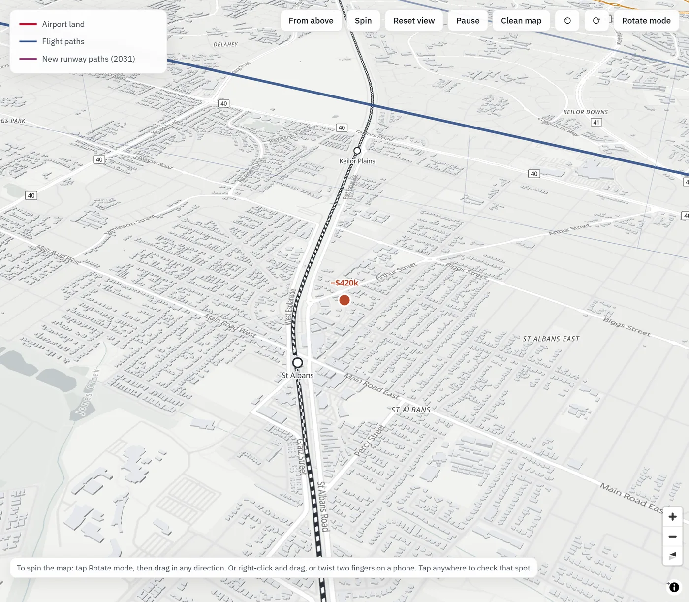
St Albans VIC 3021
Down $420,000
From $1.2m (03/2019) to $780k now, −35.0% over 7.6 years.
That's about −5.5% a year since it last sold. St Albans house prices moved up 10.7% over the last 12 months.
Your houses are saved on your device and pinned on the map, so you can compare a shortlist street by street.
What you get
Everything the listing leaves out.
One map, every suburb in your city, every figure from a named source. No more twelve tabs.
Plane noise
Today, and after the new runways open
Flight paths, plane heights and published measurements of how loud each aircraft is give every street a level. Switch to the future view to see Melbourne's third runway in 2031, or Western Sydney International's paths.
Check a house
Asking price against the suburb's trend
Enter what it's asking and what it last sold for. See the change in dollars, per year, and against how the whole suburb moved, with a pin on the map.
House prices
Median house value, 12-month change, rent and yield for each suburb, from CoreLogic figures to June 2026.
Crime
Recorded offences per 1,000 residents from official police figures, split into crimes against people and property crime.
Schools
Every rated school, placed at its official location and ranked by score, so you can find the suburbs with the best primary schools.
What's being built nearby
Data centres, train lines and motorways, both existing and planned, with their status and where the plans come from. Know about the construction site before you sign, not after.
The best suburbs, ranked your way
Sort every suburb in your city by quietest, lowest crime or best schools. A shortlist in seconds, not weekends.
Every capital
Wherever you're buying.
Each city has its own airports, flight paths and local sources. Pick yours when you sign in.
Get started
Four steps to your first check.
1
Create your free access
Your name, email and a password. No card, no catch.
2
Pick your city
Melbourne, Sydney, Brisbane, Perth, Adelaide, Hobart, Canberra or Darwin.
3
Type an address or tap a street
Or pick a suburb from the ranked list.
4
Get the full picture
Noise today and after new runways, prices, crime, schools and what's planned nearby.
You're in.
Opening your map now…
Questions
Good to know.
Is it really free?
Yes. There's no card and no trial. You just sign in with your email so you can come back to your saved houses.
Where does the information come from?
Plane noise is worked out from each airport's flight paths and runways, how high planes are at each point, and published measurements of how loud each type of aircraft is. House prices are CoreLogic figures for the 12 months to June 2026. Crime comes from official police figures in each state. School scores are from SchoolRank, with every school placed at its official government location. Maps, suburb outlines, roads and rail come from OpenStreetMap. Every figure on the map says where it came from.
How accurate is the noise level?
It's an estimate, designed to compare streets and suburbs with each other. Real noise depends on the weather, which runway is in use and the exact aircraft, so treat it as a strong guide, then visit the street at busy times before you buy.
Is this financial or property advice?
No. It's general information only. Figures are estimates and can be out of date or wrong. Check official sources and get independent advice before you buy.
What do you do with my details?
We use them to give you access and, only if you tick the box, to email you when your city gets new data. We never sell them, and you can ask us to delete them at any time.
Don't find out on the first night.
Check the street before you make an offer. It's free, and it takes a minute.